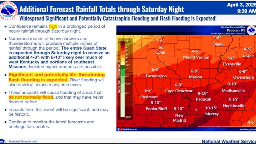
The National Weather Service has issued a Special Weather Statement with below wind chills expected early Saturday morning. Meteorologists indicate another Artic high pressure system will move into the Ohio Valley Saturday bringing a surge of frigid air into our region tonight. Overnight lows will be in the single digits in most areas with wind chills early Saturday morning from zero to eight below zero in much of the area.
According to the National Weather Service, a south wind flow will develop Sunday and Sunday night bringing moisture northward, setting the stage for widespread precipitation Sunday afternoon and evening and continuing into Monday morning. In many areas, meteorologists indicate the precipitation will likely be in the form of a wintry mix of sleet and freezign rain before enough warm air changes it over to rain by Monday morning. Although heavy amounts are not expected, travel could be impacted Sunday afternoon and night.
WebReadyTM Powered by WireReady® NSI