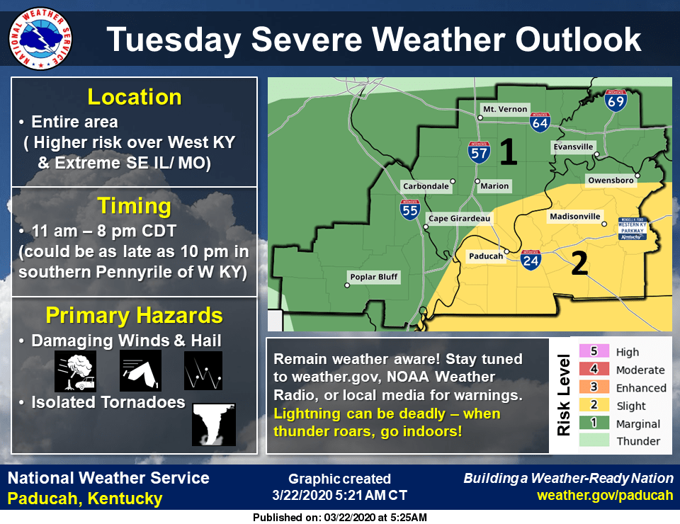
The Paducah National Weather Service office says ingredients appear to be coming together for another chance for severe weather Tuesday.
They report a strong low-pressure system off the California coast this weekend is expected to move quickly into the central U.S. late Monday. The timing of this weather system may impact the coverage and intensity of strong to severe storms in the region on Tuesday, so there remains some uncertainty regarding the overall impact of this system.
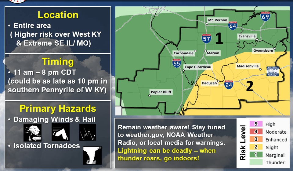
They add given the strength of this low-pressure system, the Storm Prediction Center has placed most of west Kentucky in a slight risk of severe thunderstorms for Tuesday and Tuesday night.
In addition, some of the latest models suggest some strong to severe storms may develop as early as 11:00 AM over parts of southeast Missouri, then working eastward during the afternoon. The best chance for strong to severe storms appears to be during the afternoon and early evening hours over west Kentucky. Damaging winds and hail will be the primary concern, but an isolated tornado cannot be ruled out, especially over west Kentucky, generally east of the Mississippi River and eastward into the Pennyrile region.


