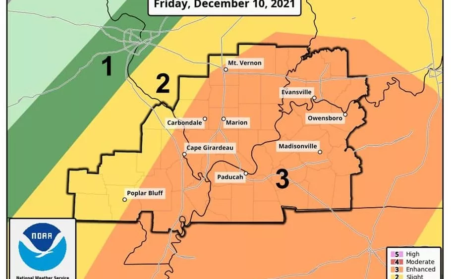
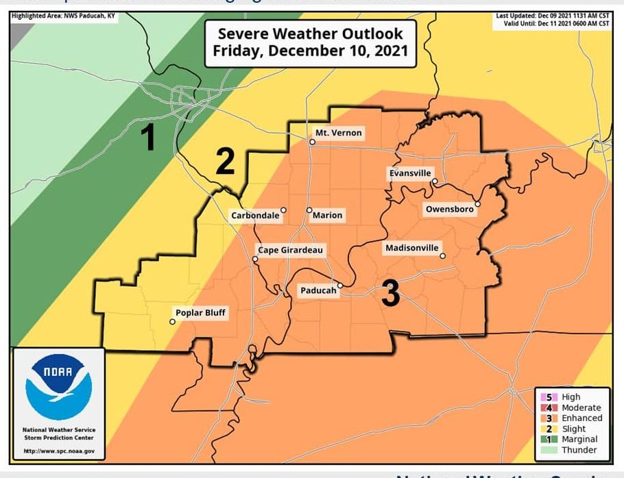
The National Weather Service says there is an enhanced risk of severe storms in western Kentucky Friday night that could bring damaging winds and tornadoes.
The weather service upgraded the risk from slight to enhanced for all of western Kentucky and northwest Tennessee.
Weather Edge forecaster David Powell says there will be some rain overnight Thursday and how cloudy it is after that rain will determine the severity of Friday night’s weather.
click to download audioPowell says regional forecasters are predicting severe weather for the night-time hours Friday, which makes it hard to see the storm clouds forming.
click to download audioPowell went on to say the storms could be severe and says to have a plan in place.
click to download audioAccording to National Weather Service data, there have been no confirmed tornadoes in Christian, Caldwell, or Todd counties since 1963. The only December tornado in Trigg County in the last 60 years happened on New Year’s Eve in 2018 when an EF-1 tornado touched down just offshore in Lake Barkley near Blue Water Estates. The tornado tracked eastward through part of the subdivision, damaging at least six homes