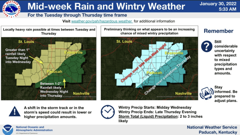
The National Weather Service in Paducah is continuing to track an artic cold front that could produce heavy rainfall and a winter weather across the region later this week.
The National Weather Service says confidence is increasing that Southeast Missouri, Southern Illinois, Southwest Indiana, and West Kentucky could be impacted by a significant weather system Tuesday through Thursday. An Arctic cold front is expected to move southeast into the region as early as Wednesday morning, pushing through the entire region by early Thursday.
Moderate to heavy rainfall, capable of producing some flooding will be possible ahead of the front. Along and behind the front, some accumulations of snow and ice are forecast which could impact travel and property across the area.
There is still too much uncertainty on the track of this system to pinpoint specific amounts and timing in detail. Please continue to monitor the latest forecasts and statements from the National Weather Service.


