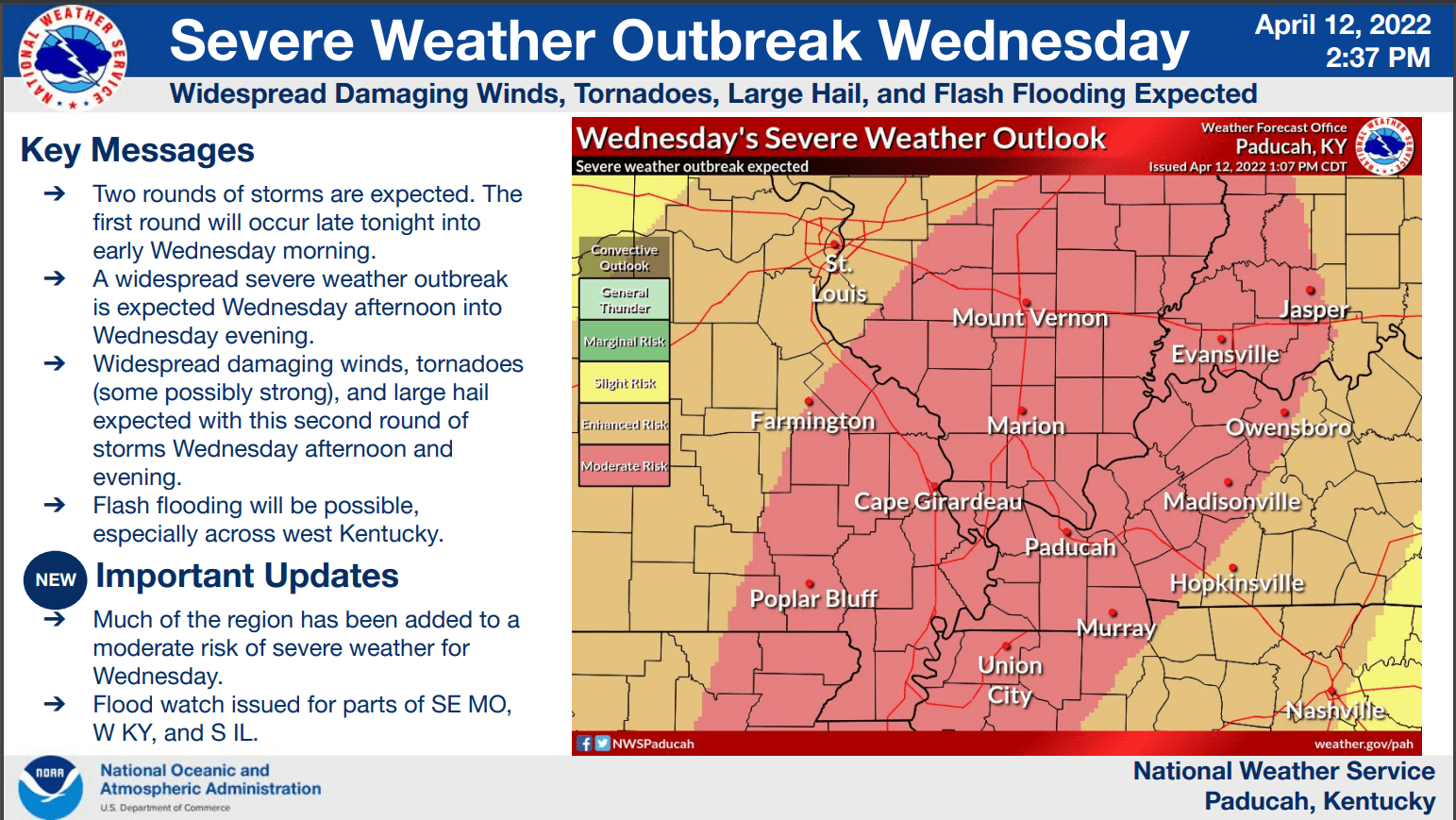
Parts of western Kentucky will be at a moderate risk of severe weather Wednesday as storms producing damaging winds and potential tornadoes move through the area.
Derrick Snyder, a meteorologist with the National Weather Service in Paducah, said the first wave of storms will move through overnight and end Wednesday morning.
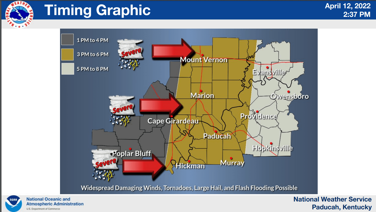
click to download audioSnyder says the severe threat of storms will appear in western Kentucky in the afternoon hours.
click to download audioHe said there will be the possibility of discreet supercells or pop-ups that will be ahead of the main line of storms and produce constant wind speeds of 40 to 50 miles per hour.
click to download audioSnyder said the storms will move through Trigg, Caldwell, and Christian counties between 5 and 8 Wednesday evening.
click to download audioA flash flood watch will be in effect from 6 Wednesday morning to 11 Wednesday night as 2 to 3 inches of rain is expected to come with the storm system.