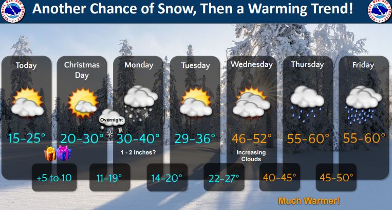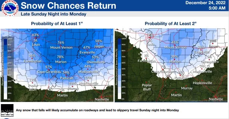

Beginning late Christmas night and into early Monday morning, the National Weather Service is expecting much of west Kentucky, southern Illinois, southern Indiana and southeast Missouri to receive at least a 1-inch blanket of snow — and perhaps two inches in certain portions.
This, of course, directly follows the arctic blast all of the region received this past Thursday, and this new wintry mix is expected to make travel difficult at the close of the weekend.
Temperatures will be in the mid-20s Sunday, but the wind chill values are expected to remain as low as minus-7, and a consistent west wind will help maintain snow drifts.
By Sunday night, temperatures will be down in the low teens along with the wind chill. Monday afternoon, western Kentuckians can expect mostly cloudy skies and a high just above freezing, but by Monday night temperatures will hover around 15.
Melting of the mess will begin on Tuesday, with mostly sunny skies and a high of 35 forecasted. By the end of the work week, rain should return — with temperatures flipping to the low-60s.