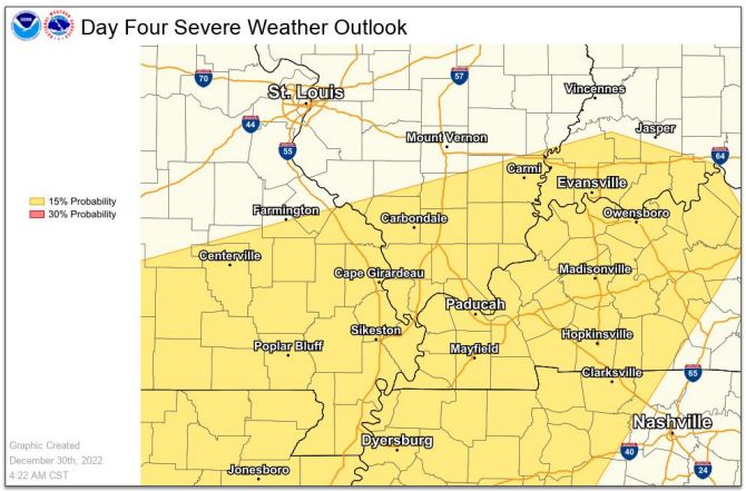

As of late Friday afternoon, officials with the National Weather Service in Paducah noted they will be “keeping an eye” on the western Kentucky forecast expected for Monday night into early Tuesday morning — as strong storms remain possible for the region.
Though instability will be limited, computer model guidance reportedly indicates “strong shear” — bringing about a “good deal” of uncertainty and differing forecast models.
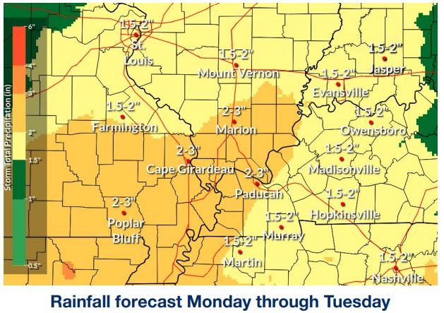
What is expected is another long stretch of rain and thunderstorms, with locally-heavy rain developing late Monday night and into Tuesday.
Amounts of 1 ½ to 2 ½ inches are plausible, with the heaviest rains coming in the southeast Missouri bootheel, southern Illinois and far western Kentucky along the Ohio River.
Minor flooding issues are a concern, because top soil has been so saturated with recent snows and rains before and after the Christmas holiday.


