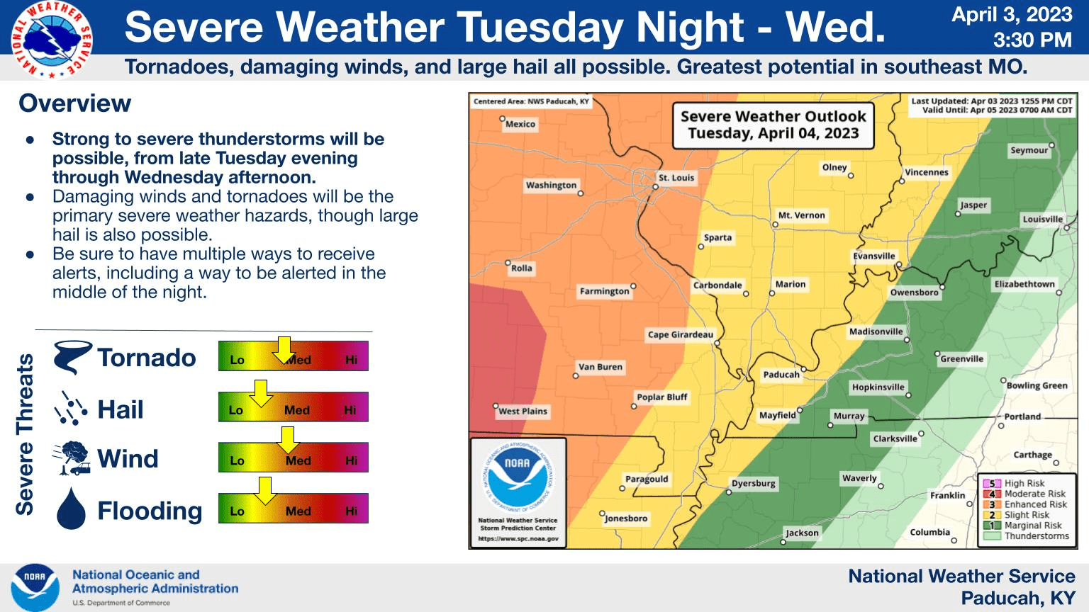
The National Weather Service is keeping an eye on the potential for more severe weather that could move through western Kentucky overnight Tuesday into Wednesday morning.
The Storm Prediction Center has placed most of western Kentucky into the slight risk category. Sean Paulos is a forecaster with the National Weather Service office in Paducah. He said Tuesday will be dry with the potential for record high temperatures with our first 80-degree readings of the year.
click to download audioDepending on what happens with the system in Arkansas and Missouri, the severe chances could be upgraded early Wednesday.
click to download audioThe National Weather Service had a storm survey team in Hopkinsville Saturday and said Friday night’s storm damage was the result of straight-line winds that reach 80 to 90 mph. While a severe thunderstorm warning had been issued for southern Christian County about 35 minutes prior, there was no warning issued with the storm that moved through Hopkinsville until storm damage had already been reported.
Paulos was asked why the system did not meet the criteria for a severe thunderstorm warning to be issued, which is the basis for storm sirens in the city to be activated.
click to download audioAfter Wednesday’s threat of severe weather, Paulos said it will be cooler and dry through the weekend.
click to download audioMarch’s rainfall of 7.11 inches was not enough to make it one of the ten wettest months here, however, rainfall for the year is still tracking about four inches above normal.