Wintry weather conditions could arrive for western Kentucky next week.
However, the immediate focus shifts to possible freezing temperatures and snow accumulations in southeast Missouri and southern Illinois Friday night and Saturday morning — with those storms shifting into southern Indiana, southern Ohio and northern Kentucky through the weekend.
Justin Gibbs, meteorologist with Paducah’s National Weather Service operation, said while the front isn’t the most impacting — roadways, overpasses and elevated paths could require cautious driving.
For those headed that direction going into the weekend, precipitation of 1-to-2 inches is expected behind the front, with potential for road slush late in the night.
Over the Friday evening hours, Gibbs noted those temperatures will clearly delineate at the Ohio River — above freezing south of it and into western Kentucky, and below freezing north of it. He called it a “quicker-moving” and “colder-than-expected” system, with marginal lows between 30 and 32 degrees.
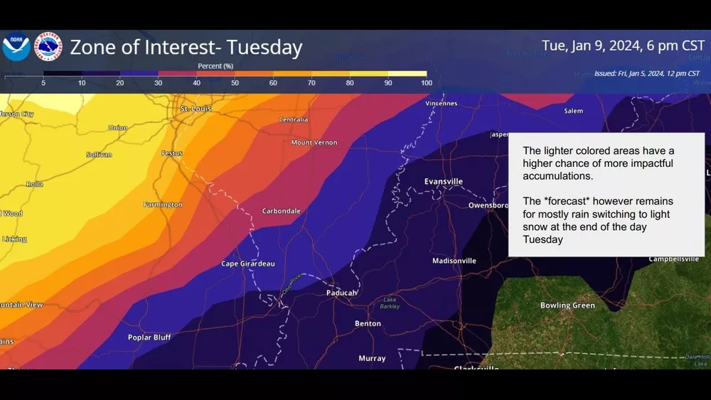
Where things get interesting for west Kentucky begins next Tuesday, and Gibbs said the NWS is “more confident” to see chances for impacts here.
He added there’s plenty of time to evaluate and that models have been on watch for several days, but that it may blanket north of the Ohio, and glaze south of it.
If snow doesn’t fall in west Kentucky, Gibbs said strong winds are quite likely.
Gibbs noted next Tuesday could be a “wind advisory type of day,” but that it shouldn’t be like March 3, 2023, where consistent straight-line 60 mile-an-hour gusts created some chaos in the News Edge listening area.
Precipitation should begin late Monday night, and move northeast through most of Tuesday.
As for next Friday, Gibbs said it’s “too early” for sincere insight, but that the NWS is well aware of public interest in another potential front coming from the Midwest.