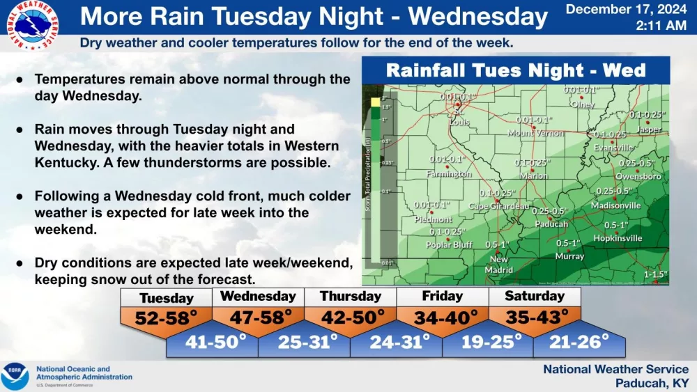
Officials with the National Weather Service Paducah Office have issued a Flood Watch for Calloway, Trigg, Christian and Todd counties — one that will remain in effect from midnight Tuesday through Wednesday morning.
Expected to potentially impact the major cities of Murray, Cadiz, Hopkinsville and Elkton, meteorologists believe flash flooding could be caused by possible excessive rainfall in certain areas.
Excessive runoff, it’s believed, may result in the flooding of rivers, streams and other low-lying, flood-prone locations. Storm drains and ditches maybe become clogged with debris. Area creeks and streams are already running high, and could flood with more heavy rain on the way.
Additional heavy rain has been forecasted from thunderstorms that will develop over the area early Wednesday morning, and bring more than 1-to-2 inches of rain. Locally higher amounts are possible. Streams and soils are saturated from Monday’s band of showers and storms, and isolated flash flooding and widespread “nuisance flooding” are “likely” in the midweek.
In southwestern Kentucky, there is a guarantee for showers and thunderstorms Tuesday night. Temperatures are expected to fall into the mid-40s, then later rising to the low 60s. Showers and thunderstorms are also likely before noon Wednesday, before cloudy skies give way to mostly sunny ones.
Since Monday, rain totals in Calloway, Trigg, Christian and Todd counties have been impressive for this time of year. According to the Kentucky Mesonet, Calloway received 2.21 inches, Trigg had 2.07 inches, another 1.2 inches arrived in Christian, and another 1.64 inches came to Todd.
This is after most of the region received at least a half-inch of rain December 8.
In the event lowland flooding does occur, turn around, don’t drown.


