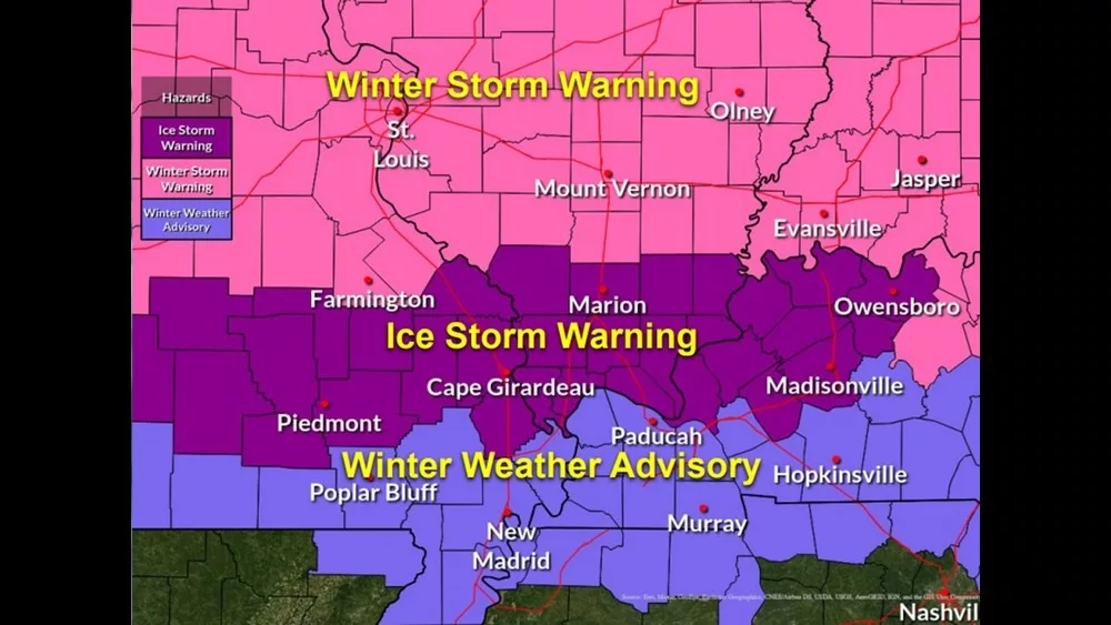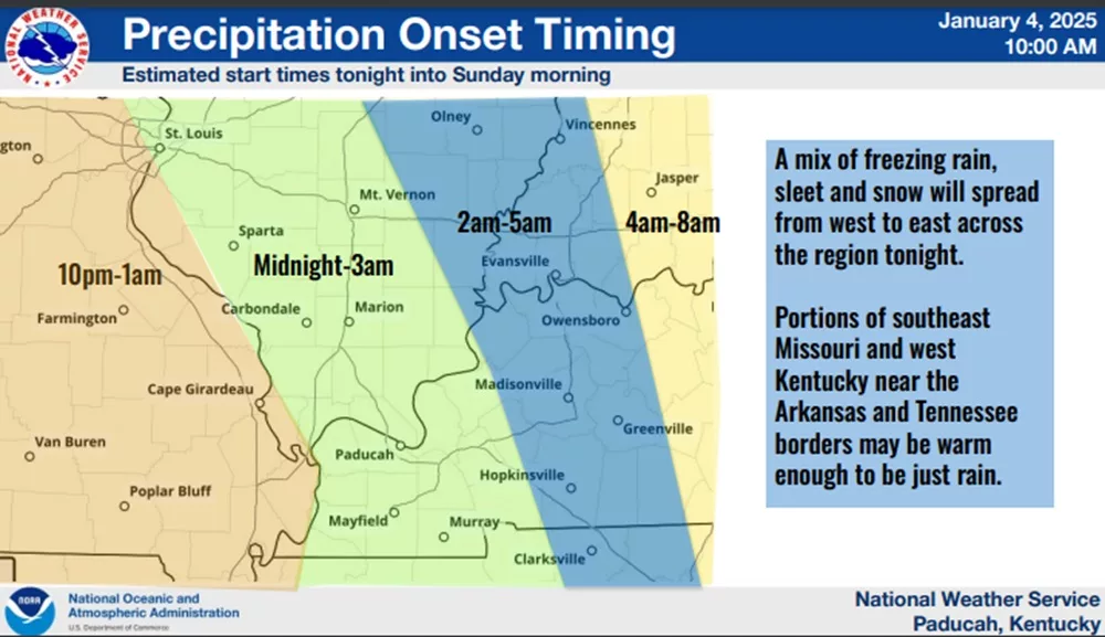
During a Saturday morning teleconference, officials with the National Weather Service in Paducah released details on the latest track of a major winter storm expected to move across the region, prompting a winter weather advisory and ice storm warning to be issued for counties in western Kentucky.
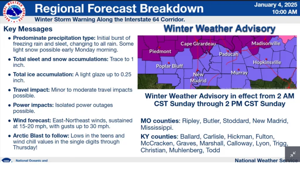
Lead Meteorologist Derrick Snyder said that a winter weather advisory will be in place from 2:00 AM to 2:00 PM on Sunday for the counties in far western Kentucky, including those near the Kentucky-Tennessee state line.

He mentioned that, along with the possibility of up to one inch of sleet and snow, some areas in the winter weather advisory might also experience a thin layer of ice.
click to download audioHe noted that near the Tennessee-Arkansas border, the threat appears to be more sporadic due to extended periods of rain, resulting in less of an impact compared to areas further north.
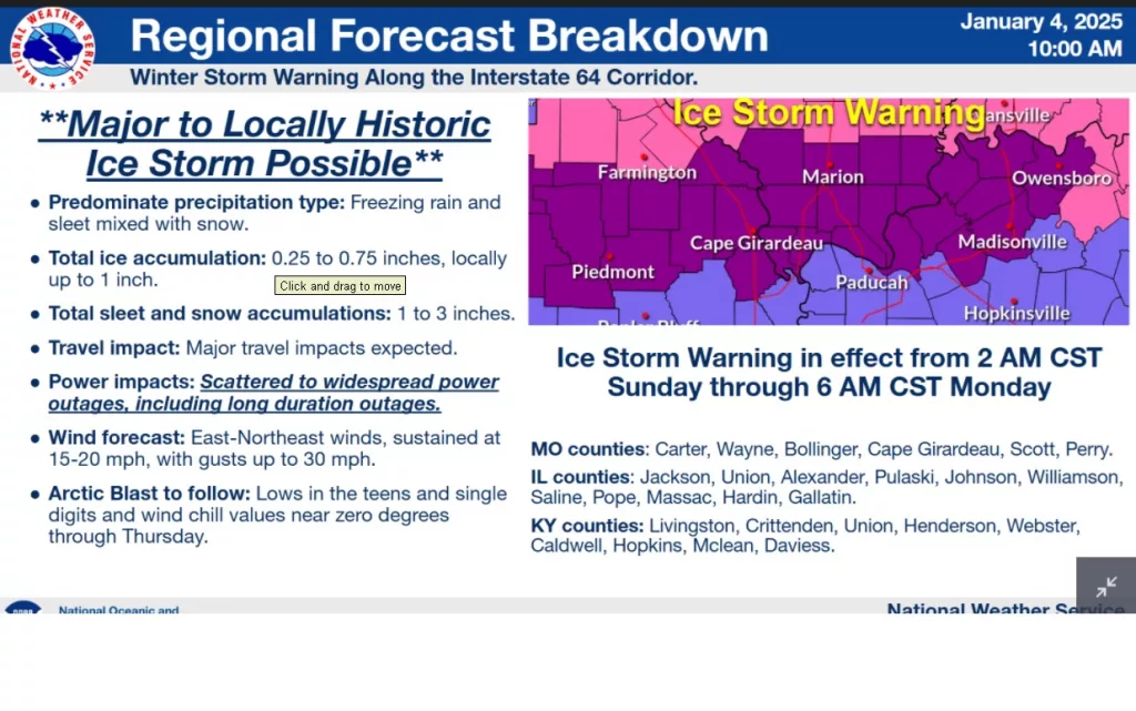
Additionally, Snyder stated that significant travel disruptions and widespread power outages are anticipated in the counties under an ice storm warning. This warning is in effect from Sunday morning through Monday morning for parts of Missouri, southern Illinois, and the Kentucky counties of Caldwell, Crittenden, Daviess, Henderson, Hopkins, Livingston, McLean, Webster, and Union.

He indicated that the ice storm warning totals have risen, primarily affecting a corridor that extends from Missouri into southern Illinois and the counties in northwestern Kentucky.
click to download audioSnyder expressed concern about scattered to widespread power outages, in addition to the significant travel disruptions caused by the freezing rain, sleet, and snow.
click to download audioHe mentioned that similar issues will arise as an arctic blast is expected to follow the precipitation, bringing temperatures down to the teens and single digits. He noted this cold spell is likely to persist until at least Thursday before temperatures begin to rise and will be a dangerous situation if there are widespread power outages.
Snyder noted that while this ice storm won’t be as severe as the one in 2009, it is likely the most significant ice storm since then.


