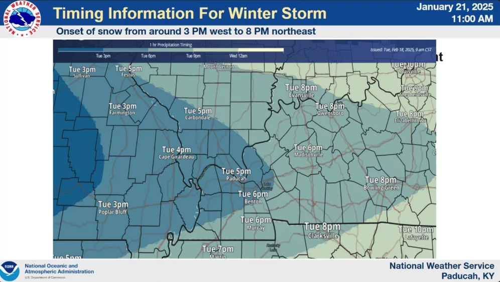
The Winter Storm Warning for western Kentucky continues with forecasters saying the system has moved slightly south in the past 24 hours, which has meant revised snowfall estimates.
Meteorologist Daniel Spaeth says Trigg, Christian, and Todd counties should see between three and six inches of snow today and tonight, while areas of Caldwell, Hopkins, and Lyon counties could see up to eight inches.
Either way, Spaeth says travel will be tricky later tonight and tomorrow.
click to download audioSpaeth says the heaviest snow will move across the lakes between 5:00 and 6:00 tonight and end at 5:00 tomorrow morning.
click to download audioSpaeth says the snow will be of the dry variety, which means there is the possibility of drifting in spots.
click to download audioOnce the snow moves through, much colder weather will follow with single-digit lows Wednesday and Thursday with below-zero wind chills late Wednesday night into Thursday morning.
click to download audioTemperatures will get above freezing on Saturday and move into the 40s on Sunday.
Not all of the weather news is bad, however. Spaeth says temperatures for the last week of February and the first few weeks of March are looking to be above normal. However, rainfall is also expected to be above normal for the same period.