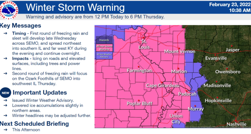
A Winter Storm Warning from the National Weather Service remains in effect for most of the I-57/I-24 corridor until noon Wednesday until 6 p.m. Thursday — in what could bring impacts to travel near the Ohio and Mississippi rivers.
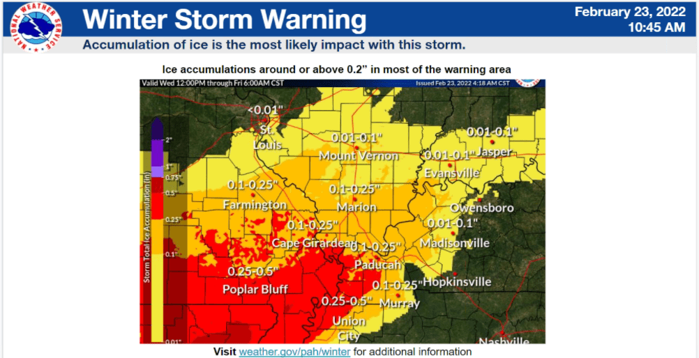
During a Wednesday morning weather conference, Lead Forecaster Chris Noles noted the two waves of expected precipitation could bring up to a half-inch of ice for west Kentucky’s river counties, and between a tenth and a quarter-inch of ice for parts of Calloway, Marshall, Lyon, Caldwell, Christian, Trigg, Hopkins and Crittenden counties — especially if the front drifts a little further south.
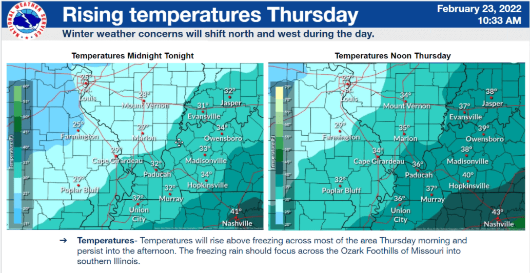
Noles said latest forecasts are showing lower-than-expected temperatures — particularly around the Ohio River corridor.
Still, temperatures in west Kentucky are expected to be at or just north of freezing at midnight and north of freezing at noon Thursday — which brings in the possibility of sleet or even slight snow.
Noles said round two of this storm is expected early Thursday, and brings with it a concern for potential freezing rain in the morning — and excessive rainfall later in the afternoon.
This particular storm system also remains electrically charged and active. Noles said they are seeing considerable amounts of lightning in northeast Arkansas, and excessive thunder could bring more precipitation.
By the end of Thursday night, temperatures will be warm enough to avoid more freezing precipitation. However, as reported earlier, most of west Kentucky will have experienced more than five inches of rain in the last 72 hours — and low-lying areas can’t be ruled out for flash flooding concerns.