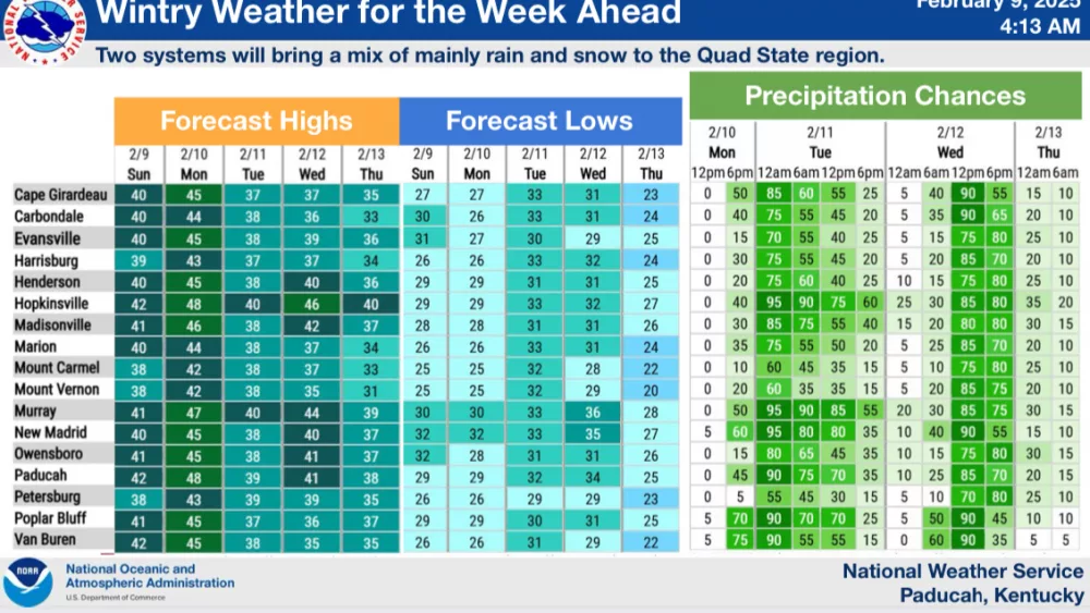
The National Weather Service says Western Kentucky could still receive a wintry mix of precipitation this week, but warmer temperatures have decreased the threat for hazardous driving conditions.
Paducah Senior Forecaster Keith Cooley says the region is still looking at chances of wintry weather moving in for the first half of the work week. There has been a trend toward slightly warmer systems, bringing a bit more rainfall to the Quad State.
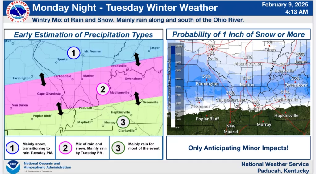
The first system Monday night through Tuesday afternoon will bring chances for rain and snow with only minor impacts expected.
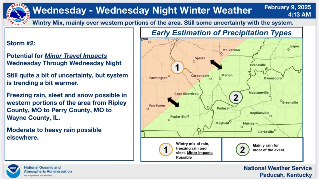
The second system may have some freezing rain and sleet, largely along and west of a line from Ripley County, MO northeast to Wayne County, IL. There is still a lot of uncertainty with the second system.
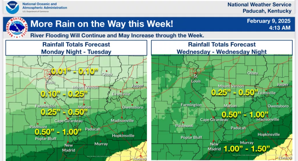
Finally, both systems will have quite a bit of moisture which will lead to many locations seeing an inch or more of rainfall through Wednesday night. This will lead to additional rises and flooding potential on area rivers.